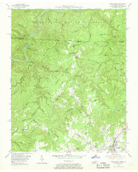
1955 Map of Oneida North
USGS Topo · Published 1968About this map
The Kentucky Tennessee state line bisects this 1955 survey, highlighting the remote timber and coal lands of the Cumberland National Forest north of Oneida. The landscape is dominated by the steep dissection of the South Fork of the Cumberland River and the prominent Chestnut Ridge. Local life in this mid-century period is anchored by small rural schoolhouses like Atomic Sch and Williams Creek Sch, and numerous mountain churches such as Pine Creek Ch and Grave Hill Ch.
Find a feature on this map
98 named features on this map. Tap any name to fly to it.
Don’t see what you’re looking for? This feature index may not catch every label — zoom into the map to look around manually.
Map Details
Editions of this 1955 Oneida North Map
4 editions found
Other maps of this area

1890 · Williamsburg
USGS Topo · 1:125,000

1893 · Briceville
USGS Topo · 1:125,000

1894 · Williamsburg
USGS Topo · 1:125,000

1895 · Wartburg
USGS Topo · 1:125,000

1895 · Briceville
USGS Topo · 1:125,000

1896 · Wartburg
USGS Topo · 1:125,000

1896 · Briceville
USGS Topo · 1:125,000

1934 · Barthell
USGS Topo · 1:62,500

1952 · Helenwood
USGS Topo · 1:24,000

1952 · Honey Creek
USGS Topo · 1:24,000