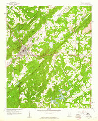
1958 Map of Oneonta
USGS Topo · Published 1960About this map
Oneonta serves as the focal point of this 1958 survey, nestled within the long ridges of Murphree Valley between Sand Mountain and Straight Mountain. The town's mid-century layout is detailed down to individual structures, featuring the High School, a Hospital, and the Radio Tower (WCRL). The industrial character of Blount County is evident in the numerous resource extraction sites flanking the valley, including a Strip Mine and Sand Pit to the northeast and a Gravel Pit near Mt Olive Ch.
Find a feature on this map
60 named features on this map. Tap any name to fly to it.
Don’t see what you’re looking for? This feature index may not catch every label — zoom into the map to look around manually.
Map Details
Editions of this 1958 Oneonta Map
Other maps of this area

1885 · Gadsden
USGS Topo · 1:125,000

1888 · Cullman
USGS Topo · 1:125,000

1888 · Gadsden
USGS Topo · 1:125,000

1889 · Springville
USGS Topo · 1:125,000

1889 · Birmingham
USGS Topo · 1:125,000

1892 · Cullman
USGS Topo · 1:125,000

1892 · Birmingham
USGS Topo · 1:125,000

1892 · Springville
USGS Topo · 1:125,000

1892 · Gadsden
USGS Topo · 1:125,000

1895 · Gadsden
USGS Topo · 1:125,000