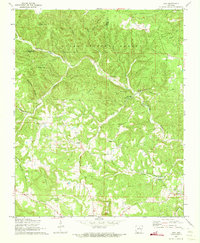
1972 Map of Onia
USGS Topo · Published 1973About this map
Ozark National Forest covers much of the northern landscape here, where the terrain is deeply incised by the Roasting Ear Creek system and its many tributaries like Dry Fork and Mill Creek. This 1970s survey captures the rural character of Stone County, defined by small settlements and family landmarks. The village of Onia serves as a central point, supported by nearby Timbo and Alco. Genealogists will find significant value in the distribution of family-named cemeteries and rural congregations, including Stevens Cem, Purdue Cem, and Bethany Ch. The map illustrates a landscape of high ridges such as Roper Mountain and Panther Mountain interspersed with landmarks like Alexander Cave and Pleasant Hill, reflecting a community closely tied to the valleys and springs of the Ozark plateau.
Find a feature on this map
40 named features on this map. Tap any name to fly to it.
Don’t see what you’re looking for? This feature index may not catch every label — zoom into the map to look around manually.
Map Details
Editions of this 1972 Onia Map
2 editions found
Other maps of this area

1890 · Mountain Home
USGS Topo · 1:125,000

1891 · Mountain Home
USGS Topo · 1:125,000

1892 · Mountain View
USGS Topo · 1:125,000

1894 · Mountain View
USGS Topo · 1:125,000

1894 · Mountain Home
USGS Topo · 1:125,000

1945 · Harrison
USGS Topo · 1:250,000

1949 · Harrison
USGS Topo · 1:250,000

1954 · Harrison
USGS Topo · 1:250,000

1956 · Russellville
USGS Topo · 1:250,000

1958 · Harrison
USGS Topo · 1:250,000