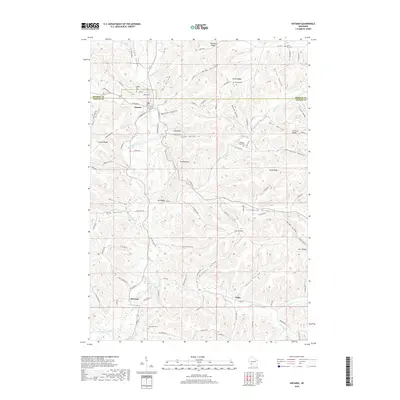
2018 Map of Ontario
USGS Topo · Published 2018About this map
The Kickapoo River meanders through a deeply dissected landscape where the villages of Ontario, Rockton, and Valley serve as central points for local commerce and rural life. The terrain is defined by a dense network of ridges and hollows, such as Wildcat Mtn and Mt Pisgah, which dictate the winding paths of roads like Co Hwy Z and Scenic Dr. This topography has preserved a traditional Wisconsin settlement pattern where cemeteries often mark the high ground or the edges of valleys, including Hilltop Rest Cem overlooking Ontario and the secluded Jug Creek Cem to the south.
Find a feature on this map
101 named features on this map. Tap any name to fly to it.
Don’t see what you’re looking for? This feature index may not catch every label — zoom into the map to look around manually.
Map Details
Editions of this 2018 Ontario Map
This is the sole edition of this map. No revisions or reprints were ever made.
Other maps of this area

1916 · Tomah
USGS Topo · 1:62,500

1919 · Kendall
USGS Topo · 1:62,500

1921 · Kendall
USGS Topo · 1:62,500

1926 · La Farge
USGS Topo · 1:62,500

1927 · Hillsboro
USGS Topo · 1:62,500

1949 · Tomah
USGS Topo · 1:62,500

1958 · La Crosse
USGS Topo · 1:250,000

1961 · La Crosse
USGS Topo · 1:250,000

1962 · Kendall
USGS Topo · 1:62,500

1965 · La Crosse
USGS Topo · 1:250,000