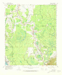
1963 Map of Onward
USGS Topo · Published 1973About this map
The Sunflower River and Yazoo River define the intricate hydrological landscape of this region during the early 1960s. The area is characterized by a dense network of bayous, including Newsom Bayou and Cane Bayou, which drain the low-lying alluvial plains. The Illinois Central Railroad serves as a primary transport spine, connecting small river settlements like Onward and Valley Park. Near the southern edge of the map, the industrial presence of the Haynes Bluff Cement Plant stands at the base of Haynes Bluff, marking a distinct shift from the surrounding agricultural and riparian terrain.
Find a feature on this map
58 named features on this map. Tap any name to fly to it.
Don’t see what you’re looking for? This feature index may not catch every label — zoom into the map to look around manually.
Map Details
Editions of this 1963 Onward Map
3 editions found

Other maps of this area

1909 · Millikens Bend
USGS Topo · 1:24,000

1918 · Vicksburg
USGS Topo · 1:62,500

1938 · Edwards
USGS Topo · 1:62,500

1939 · Onward
USGS Topo · 1:62,500

1939 · Lorenzen
USGS Topo · 1:62,500

1939 · Talla Bena
USGS Topo · 1:62,500

1939 · Alsatia
USGS Topo · 1:62,500

1939 · Mayersville
USGS Topo · 1:62,500

1940 · Mechanicsburg
USGS Topo · 1:62,500

1941 · Vicksburg
USGS Topo · 1:62,500