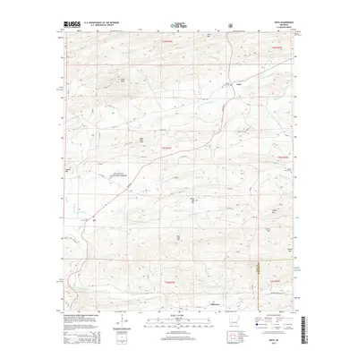
2014 Map of Onyx
USGS Topo · Published 2014About this map
Onyx and Aly serve as the primary focal points in this interior section of the Ouachita National Forest, where the terrain is defined by a series of prominent ridges and peaks. The drainage network of the Fourche LaFave River and its southern branch, the S Fourche LaFave River, carves through the land, supported by numerous named tributaries such as Haw Cr and Robertson Cr. The geography is notably rugged, with elevations climbing to White Oak Mtn, Bear Head Mtn, and Allen Peak. Small, family-named sites like Ballew Family Cem and Keener Family Cem provide important genealogical markers for the area. State Hwy 27 provides the main north-south artery through this landscape, connecting these remote settlements to the broader region at the edge of the Yell and Garland County line.
Find a feature on this map
68 named features on this map. Tap any name to fly to it.
Don’t see what you’re looking for? This feature index may not catch every label — zoom into the map to look around manually.
Map Details
Editions of this 2014 Onyx Map
This is the sole edition of this map. No revisions or reprints were ever made.
Other maps of this area

1890 · Mount Ida
USGS Topo · 1:125,000

1890 · Hot Springs
USGS Topo · 1:125,000

1894 · Hot Springs
USGS Topo · 1:125,000

1955 · Little Rock
USGS Topo · 1:250,000

1956 · Little Rock
USGS Topo · 1:250,000

1959 · Mount Ida
USGS Topo · 1:62,500

1960 · Little Rock
USGS Topo · 1:250,000

1960 · Gravelly
USGS Topo · 1:62,500

1962 · Avant
USGS Topo · 1:24,000

1962 · Fannie
USGS Topo · 1:24,000