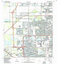
1988 Map of Opa-Locka
USGS Topo · Published 1988About this map
Miami Lakes and Carol City define this late-1980s landscape of planned communities and interconnected waterways in northern Miami-Dade. The map shows an area of significant suburban expansion, where residential grids are partitioned by major transit corridors like Floridas Turnpike and the Palmetto Expressway. A complex network of artificial lakes, such as Lake Steven and Lake Cecile, dominates the residential landscape, serving both as neighborhood centerpieces and water management features.
Find a feature on this map
85 named features on this map. Tap any name to fly to it.
Don’t see what you’re looking for? This feature index may not catch every label — zoom into the map to look around manually.
Map Details
Editions of this 1988 Opa-Locka Map
This is the sole edition of this map. No revisions or reprints were ever made.
Other maps of this area

1947 · North Miami
USGS Topo · 1:24,000

1949 · Opalocka
USGS Topo · 1:24,000

1949 · Fort Lauderdale South
USGS Topo · 1:24,000

1950 · Hialeah
USGS Topo · 1:24,000

1950 · Miami
USGS Topo · 1:24,000

1950 · North Miami
USGS Topo · 1:24,000

1956 · Miami
USGS Topo · 1:250,000

1956 · West Palm Beach
USGS Topo · 1:250,000

1957 · West Palm Beach
USGS Topo · 1:250,000

1958 · West Palm Beach
USGS Topo · 1:250,000