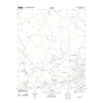
2011 Map of Opelika West
USGS Topo · Published 2011About this map
Opelika and its western residential expansions define the southeastern portion of this landscape, where established neighborhoods like Pepperell and Five Points meet newer developments such as Alta Vista and Harwell Hills. The terrain is deeply influenced by the waterways of Lee County, specifically the winding paths of Sougahatchee Creek and Little Loblockee Creek. Several man-made reservoirs, including Sougahatchee Lake and Hinkle Lake, are held by dams such as the Sougahatchee Dam and Hinkle Dam, reflecting the local water management and recreation patterns of the early 21st century.
Find a feature on this map
105 named features on this map. Tap any name to fly to it.
Don’t see what you’re looking for? This feature index may not catch every label — zoom into the map to look around manually.
Map Details
Editions of this 2011 Opelika West Map
This is the sole edition of this map. No revisions or reprints were ever made.
Other maps of this area

1906 · Dadeville
USGS Topo · 1:125,000

1907 · Opelika
USGS Topo · 1:125,000

1909 · Opelika
USGS Topo · 1:125,000

1955 · Phenix City
USGS Topo · 1:250,000

1957 · Phenix City
USGS Topo · 1:250,000

1958 · Phenix City
USGS Topo · 1:250,000

1970 · Opelika East
USGS Topo · 1:24,000

1971 · Waverly
USGS Topo · 1:24,000

1971 · Parkers Crossroads
USGS Topo · 1:24,000
1971 · Cusseta
USGS Topo · 1:24,000