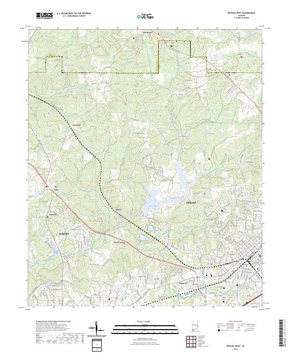
2024 Map of Opelika West
USGS Topo · Published 2024About this map
The boundary line between Chambers Co and Lee Co divides this portion of Alabama, where the urban expansion of Auburn and Opelika meets a landscape of managed lakes and historical rural settlements. Several residential and industrial developments, such as Pepperell and North Auburn, are documented alongside older landmarks like The Bottle and Stonewall.
Find a feature on this map
191 named features on this map. Tap any name to fly to it.
Don’t see what you’re looking for? This feature index may not catch every label — zoom into the map to look around manually.
Map Details
Editions of this 2024 Opelika West Map
This is the sole edition of this map. No revisions or reprints were ever made.
Other maps of this area

1906 · Dadeville
USGS Topo · 1:125,000

1907 · Opelika
USGS Topo · 1:125,000

1909 · Opelika
USGS Topo · 1:125,000

1955 · Phenix City
USGS Topo · 1:250,000

1957 · Phenix City
USGS Topo · 1:250,000

1958 · Phenix City
USGS Topo · 1:250,000

1970 · Opelika East
USGS Topo · 1:24,000

1971 · Waverly
USGS Topo · 1:24,000

1971 · Parkers Crossroads
USGS Topo · 1:24,000
1971 · Cusseta
USGS Topo · 1:24,000