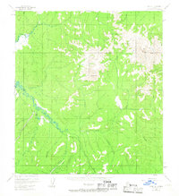
1954 Map of Ophir A-1
USGS Topo · Published 1967About this map
The Innoko River winds through the interior landscape of the Yukon-Koyukuk region, anchoring a network of remote drainages and peaks. In the mid-1950s, this area remained largely undeveloped, characterized by scattered cabins and the infrastructure of gold prospecting. A Placer Mine is recorded near the riverbank, supported by a remote Landing Strip that provided the essential connection to the outside world for miners and trappers.
Find a feature on this map
21 named features on this map. Tap any name to fly to it.
Don’t see what you’re looking for? This feature index may not catch every label — zoom into the map to look around manually.
Map Details
Editions of this 1954 Ophir A-1 Map
2 editions found
Other maps of this area

1949 · McGrath
USGS Topo · 1:250,000

1950 · Medfra
USGS Topo · 1:250,000

1950 · McGrath
USGS Topo · 1:250,000

1951 · Ophir
USGS Topo · 1:250,000

1951 · Iditarod
USGS Topo · 1:250,000

1954 · Medfra A-6
USGS Topo · 1:63,360

1954 · Ophir A-2
USGS Topo · 1:63,360

1954 · McGrath D-6
USGS Topo · 1:63,360

1954 · Ophir A-1
USGS Topo · 1:63,360

1954 · Medfra B-6
USGS Topo · 1:63,360