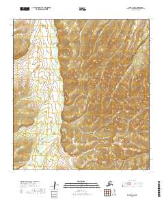
2019 Map of Ophir A-2 SE
USGS Topo · Published 2019About this map
Beaver Cr flows through the heart of this Yukon-Koyukuk landscape, serving as the central drainage for a network of mineral-named tributaries. The terrain is defined by the sharp relief of ridges separated by narrow valleys, where watercourses like Steel Cr, Dodge Cr, and Ophir Cr have historically drawn interest for their potential gold-bearing gravels. The lower portion of the map is traversed by Little Creek Road, a primary artery providing access to the more remote drainages including Little Cr and Dollar Cr. This 2019 survey documents a landscape where modern road access intersects with a topography shaped by decades of interior Alaska exploration, tracing the paths of named features like Gold Run and Victor Gulch across the township lines of the t28s r12e and t27s r12e survey blocks.
Find a feature on this map
20 named features on this map. Tap any name to fly to it.
Don’t see what you’re looking for? This feature index may not catch every label — zoom into the map to look around manually.
Map Details
Editions of this 2019 Ophir A-2 SE Map
This is the sole edition of this map. No revisions or reprints were ever made.
Other maps of this area

1951 · Ophir
USGS Topo · 1:250,000

1951 · Iditarod
USGS Topo · 1:250,000

1954 · Ophir A-2
USGS Topo · 1:63,360

1954 · Ophir A-1
USGS Topo · 1:63,360

1954 · Iditarod D-2
USGS Topo · 1:63,360

1954 · Ophir
USGS Topo · 1:250,000
1954 · Iditarod D-1
USGS Topo · 1:63,360
1955 · Iditarod D-1
USGS Topo · 1:63,360

1956 · Iditarod
USGS Topo · 1:250,000
2019 · Iditarod D-2 NE
USGS Topo · 1:25,000