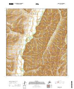
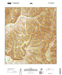
2019 Map of Ophir B-2 SE
USGS Topo · Published 2019About this map
The Innoko River winds through the heart of this interior Alaskan wilderness, cutting through the eastern reaches of the Kuskokwim Mountains. In this landscape, drainage patterns define the geography, with major tributaries such as Dominion Cr and Henry Cr flowing from the high ground of Caribou Mtn. This part of the Yukon-Koyukuk region is characterized by significant topographical shifts, where the high ridges of the Kuskokwim range descend toward the active river valley. The map details the intricate hydrography of the sub-arctic terrain, including smaller named flows like Fourmile Cr and Frying Pan Cr, which are essential markers for navigating this roadless expanse. This survey provides a precise account of the natural boundaries and elevation contours of a region primarily defined by its hydrology and mountain landforms.
Find a feature on this map
13 named features on this map. Tap any name to fly to it.
Don’t see what you’re looking for? This feature index may not catch every label — zoom into the map to look around manually.
Map Details
Editions of this 2019 Ophir B-2 SE Map
This is the sole edition of this map. No revisions or reprints were ever made.
Other maps of this area

1951 · Ophir
USGS Topo · 1:250,000

1954 · Ophir A-2
USGS Topo · 1:63,360

1954 · Ophir A-1
USGS Topo · 1:63,360

1954 · Ophir B-1
USGS Topo · 1:63,360

1954 · Ophir B-2
USGS Topo · 1:63,360

1954 · Ophir
USGS Topo · 1:250,000
1965 · Ophir B-2
USGS Topo · 1:63,360
2019 · Ophir B-2 SW
USGS Topo · 1:25,000
2019 · Ophir B-2 NE
USGS Topo · 1:25,000
2019 · Ophir A-1 NW
USGS Topo · 1:25,000