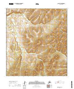
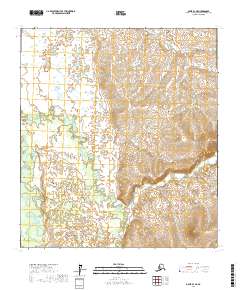
2019 Map of Ophir B-2 SW
USGS Topo · Published 2019About this map
Mastodon Cr and Mammoth Cr define the northern drainages of this Interior Alaska landscape within the Yukon-Koyukuk Census Area. The terrain is characterized by a complex network of small waterways, including Hurst Cr and Frisco Cr, which carve through the high elevations. The absence of roads or permanent structures reflects the extreme isolation typical of the Ophir region, a territory primarily shaped by its hydrology and the systematic township and range lines of the Public Land Survey System. Researchers can trace the headwaters of numerous creeks like Boob Cr and Basin Cr, whose names hint at the area's prospecting history and the nomenclature of early Alaskan mining districts.
Find a feature on this map
15 named features on this map. Tap any name to fly to it.
Don’t see what you’re looking for? This feature index may not catch every label — zoom into the map to look around manually.
Map Details
Editions of this 2019 Ophir B-2 SW Map
This is the sole edition of this map. No revisions or reprints were ever made.
Other maps of this area

1951 · Ophir
USGS Topo · 1:250,000

1954 · Ophir A-2
USGS Topo · 1:63,360

1954 · Ophir A-3
USGS Topo · 1:63,360

1954 · Ophir B-2
USGS Topo · 1:63,360

1954 · Ophir B-3
USGS Topo · 1:63,360

1954 · Ophir
USGS Topo · 1:250,000
1965 · Ophir B-2
USGS Topo · 1:63,360
2016 · Ophir A-3 NE
USGS Topo · 1:25,000
2017 · Ophir B-3 SE
USGS Topo · 1:25,000
2017 · Ophir B-3 NE
USGS Topo · 1:25,000