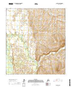
2017 Map of Ophir B-3 NE
USGS Topo · Published 2017About this map
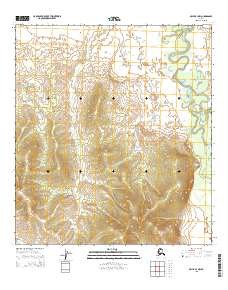
The Dishna River meanders through this portion of the Yukon-Koyukuk Census Area, defining the western drainage patterns of a landscape marked by significant watercourse networks. This 2017 survey captures the intricate paths of Tolstoi Creek and its smaller counterpart Tolstoi Cr, which dominate the central and southern terrain. These waterways are part of the broader Innoko River watershed, a region historically significant for its interior Alaskan wilderness character. The presence of Coffee Cr in the north and Madison Cr in the east suggests a highly saturated landscape where elevation changes are defined more by the cuts of these streams than by dramatic peaks. This map provides a detailed look at the Public Land Survey System grid, including boundaries for t23s r9e and t24s r9e, offering a precise view of township and range divisions in a region without established road infrastructure.
Find a feature on this map
11 named features on this map. Tap any name to fly to it.
Don’t see what you’re looking for? This feature index may not catch every label — zoom into the map to look around manually.
Map Details
Editions of this 2017 Ophir B-3 NE Map
This is the sole edition of this map. No revisions or reprints were ever made.
Other maps of this area

1951 · Ophir
USGS Topo · 1:250,000

1954 · Ophir C-3
USGS Topo · 1:63,360

1954 · Ophir C-2
USGS Topo · 1:63,360

1954 · Ophir B-2
USGS Topo · 1:63,360

1954 · Ophir B-3
USGS Topo · 1:63,360

1954 · Ophir
USGS Topo · 1:250,000
1965 · Ophir B-2
USGS Topo · 1:63,360
2015 · Ophir C-3 SW
USGS Topo · 1:25,000
2015 · Ophir B-3 SW
USGS Topo · 1:25,000
2015 · Ophir B-3 NW
USGS Topo · 1:25,000