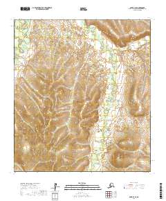
2017 Map of Ophir B-3 SE
USGS Topo · Published 2017About this map
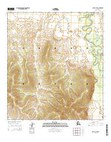
The Dishna River winds through the northwestern corner of this interior Alaskan landscape, establishing the primary drainage for a region defined by its intricate network of creek systems. The terrain is shaped by the descent of water from several unnamed ridges into valleys carved by Tolstoi Cr, Mastodon Cr, and the curiously named Boob Cr in the northeast. This 2017 survey reveals a remote wilderness devoid of established roads or settlements, where the surveyor's grid of T24S through T26S provides the only human-imposed structure. Researchers focusing on the Yukon-Koyukuk region will find the precise courses of Ledge Cr and Basin Cr particularly useful for orienting themselves within this specific section of the Ophir quadrangle, where the natural hydrography serves as the only reliable landmark.
Find a feature on this map
15 named features on this map. Tap any name to fly to it.
Don’t see what you’re looking for? This feature index may not catch every label — zoom into the map to look around manually.
Map Details
Editions of this 2017 Ophir B-3 SE Map
This is the sole edition of this map. No revisions or reprints were ever made.
Other maps of this area

1951 · Ophir
USGS Topo · 1:250,000

1954 · Ophir A-2
USGS Topo · 1:63,360

1954 · Ophir A-3
USGS Topo · 1:63,360

1954 · Ophir B-2
USGS Topo · 1:63,360

1954 · Ophir B-3
USGS Topo · 1:63,360

1954 · Ophir
USGS Topo · 1:250,000
1965 · Ophir B-2
USGS Topo · 1:63,360
2015 · Ophir A-3 NW
USGS Topo · 1:25,000
2015 · Ophir B-3 SW
USGS Topo · 1:25,000
2015 · Ophir B-3 NW
USGS Topo · 1:25,000