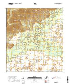
2019 Map of Ophir D-2 SE
USGS Topo · Published 2019About this map
Innoko River meanders across this landscape in the Yukon-Koyukuk region, creating a complex network of oxbows and wetlands. The geography is defined by the convergence of major waterways, including the North Fork Innoko River and the tributary Slow Cr. This map captures a remote section of the Alaskan interior where the shifting river channels are the primary geographical features, illustrating the natural hydrological evolution of the floodplains. The lack of named settlements or infrastructure highlights the wilderness character of the territory during this 2019 survey, providing a clear record of the undisturbed terrain and drainage patterns typical of this portion of the Innoko watershed.
Find a feature on this map
7 named features on this map. Tap any name to fly to it.
Don’t see what you’re looking for? This feature index may not catch every label — zoom into the map to look around manually.
Map Details
Editions of this 2019 Ophir D-2 SE Map
This is the sole edition of this map. No revisions or reprints were ever made.
Other maps of this area

1951 · Ophir
USGS Topo · 1:250,000
1954 · Ophir D-1
USGS Topo · 1:63,360

1954 · Ophir C-1
USGS Topo · 1:63,360

1954 · Ophir C-2
USGS Topo · 1:63,360
1954 · Ophir D-2
USGS Topo · 1:63,360

1954 · Ophir
USGS Topo · 1:250,000
2019 · Ophir C-2 NE
USGS Topo · 1:25,000
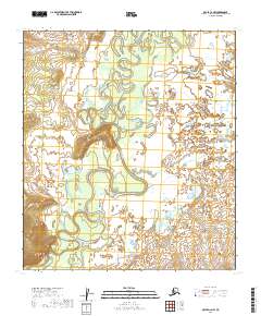
2019 · Ophir C-2 NW
USGS Topo · 1:25,000
2019 · Ophir D-2 NW
USGS Topo · 1:25,000
2019 · Ophir D-2 NE
USGS Topo · 1:25,000