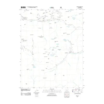
2011 Map of Ophir
USGS Topo · Published 2011About this map
Ophir and the historic Ophir Loop serve as the focal points for this high-altitude landscape, which is defined by a dense concentration of hard-rock mining claims. The terrain is marked by a complex network of industrial heritage, with sites like the Gold King Mine, Carbonero Mine, and the Ophir Tunnel Mine clustered around Silver Mountain and Staatsburg Basin. This map captures the intersection of early mining development and modern recreational use, showing the rugged paths of Co RD 8 and Co RD 12 through the peaks. Water management for industrial and local needs is evident in the presence of the Alta Reservoir Number 1 and its associated Alta Number 1 Dam, along with the Bridal Veil Dam to the north. From the Ophir Post Office to the high crossing at Ophir Pass, the map details a region where geology and resource extraction have dictated the location of every settlement and road.
Find a feature on this map
117 named features on this map. Tap any name to fly to it.
Don’t see what you’re looking for? This feature index may not catch every label — zoom into the map to look around manually.
Map Details
Editions of this 2011 Ophir Map
This is the sole edition of this map. No revisions or reprints were ever made.
Other maps of this area

1897 · Telluride
USGS Topo · 1:62,500

1897 · Silverton
USGS Topo · 1:62,500

1898 · Engineer Mountain
USGS Topo · 1:62,500

1900 · Engineer Mountain
USGS Topo · 1:62,500

1900 · Needle Mountains
USGS Topo · 1:62,500

1901 · Silverton
USGS Topo · 1:62,500

1902 · Needle Mountains
USGS Topo · 1:62,500

1902 · Silverton
USGS Topo · 1:62,500

1904 · Telluride
USGS Topo · 1:62,500

1908 · Engineer Mountain
USGS Topo · 1:62,500