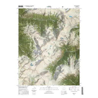
2016 Map of Ophir
USGS Topo · Published 2016About this map
Ophir stands as a focal point in this high-altitude landscape of the San Juan Mountains, situated along the Howard Fork of the San Miguel River. The map illustrates a complex network of historic transit and mining activity, including the Ophir Loop and the formidable Ophir Pass that connects the region over the continental divide. To the south and east, the terrain is defined by jagged summits such as Ulysses S Grant Peak, Vermilion Peak, and Beattie Peak, which tower over alpine basins like Ice Lake Basin and Bridal Veil Basin. The presence of Golden Horn suggests the area's rich prospecting history, while numerous trails like the Rico - Silverton Trail / Colorado Trail and Camels Garden Trail weave through the Uncompahgre National Forest and San Juan National Forest, marking paths long used by miners and early travelers.
Find a feature on this map
69 named features on this map. Tap any name to fly to it.
Don’t see what you’re looking for? This feature index may not catch every label — zoom into the map to look around manually.
Map Details
Editions of this 2016 Ophir Map
This is the sole edition of this map. No revisions or reprints were ever made.
Other maps of this area

1897 · Telluride
USGS Topo · 1:62,500

1897 · Silverton
USGS Topo · 1:62,500

1898 · Engineer Mountain
USGS Topo · 1:62,500

1900 · Engineer Mountain
USGS Topo · 1:62,500

1900 · Needle Mountains
USGS Topo · 1:62,500

1901 · Silverton
USGS Topo · 1:62,500

1902 · Needle Mountains
USGS Topo · 1:62,500

1902 · Silverton
USGS Topo · 1:62,500

1904 · Telluride
USGS Topo · 1:62,500

1908 · Engineer Mountain
USGS Topo · 1:62,500