
1934 Map of Oquawka
USGS Topo · Published 1934About this map
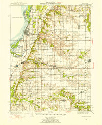
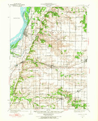
Oquawka stands at the edge of the Mississippi River, serving as a focal point for a landscape defined by its intricate network of river sloughs and productive Illinois farmland in the early 1930s. The riverfront is characterized by numerous islands and backwaters, including Benton Island and Fernal Island, which transition into the bottomlands of Gladstone. To the east, the terrain rises into upland prairies and wooded breaks, where the Chicago Burlington and Quincy railroad cuts through the countryside, connecting agricultural hubs like Biggsville and Kirkwood.
Find a feature on this map
76 named features on this map. Tap any name to fly to it.
Don’t see what you’re looking for? This feature index may not catch every label — zoom into the map to look around manually.
Map Details
Editions of this 1934 Oquawka Map
3 editions found
Other maps of this area

1916 · Good Hope
USGS Topo · 1:62,500

1918 · La Harpe
USGS Topo · 1:62,500

1918 · Good Hope
USGS Topo · 1:62,500

1921 · Monmouth
USGS Topo · 1:62,500

1923 · Monmouth
USGS Topo · 1:62,500

1923 · Alexis
USGS Topo · 1:62,500

1925 · Alexis
USGS Topo · 1:62,500

1932 · Lomax
USGS Topo · 1:62,500

1934 · Burlington
USGS Topo · 1:48,000

1935 · Keithsburg
USGS Topo · 1:48,000