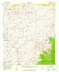
1959 Map of Oracle
USGS Topo · Published 1961About this map
The town of Oracle serves as the focal point for this late-1950s study of the high desert and mountain interface. Stretching from the Tortolita Mountains in the west to the high peaks of the Coronado National Forest in the east, the landscape is defined by a network of cattle operations and mining claims. Prominent ranching homesteads such as Willow Springs Ranch, Falcon Valley Ranch, and Rancho Linda Vista illustrate the regional economy, while the Experimental Ranch south of the main town site suggests an era of scientific land management.
Find a feature on this map
133 named features on this map. Tap any name to fly to it.
Don’t see what you’re looking for? This feature index may not catch every label — zoom into the map to look around manually.
Map Details
Editions of this 1959 Oracle Map
2 editions found
Other maps of this area

1904 · Tucson
USGS Topo · 1:125,000

1905 · Tucson
USGS Topo · 1:125,000

1911 · Winkelman
USGS Topo · 1:125,000

1913 · Winkelman
USGS Topo · 1:125,000

1934 · Tucson Mountains
USGS Topo · 1:125,000

1934 · Newman Peak
USGS Topo · 1:125,000

1947 · Cortaro
USGS Topo · 1:62,500

1948 · Mammoth
USGS Topo · 1:62,500

1948 · Mammoth
USGS Topo · 1:24,000

1948 · Campo Bonito
USGS Topo · 1:24,000