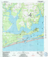
1980 Map of Orange Beach
USGS Topo · Published 1980About this map
Wolf Bay and the intricate network of surrounding bayous define this coastal Alabama landscape during a period of significant growth. The map illustrates the maritime character of Orange Beach and Caswell before the extensive modern high-rise development of later decades. Essential water routes like the Intracoastal Waterway and the Old Perdido River slice through the terrain, connecting the inland bay system to the Gulf Of Mexico via Perdido Pass.
Find a feature on this map
53 named features on this map. Tap any name to fly to it.
Don’t see what you’re looking for? This feature index may not catch every label — zoom into the map to look around manually.
Map Details
Editions of this 1980 Orange Beach Map
2 editions found
Other maps of this area

1921 · Bon Secour
USGS Topo · 1:62,500

1921 · Fort Barrancas
USGS Topo · 1:62,500

1941 · Fort Barrancas
USGS Topo · 1:62,500

1941 · Foley
USGS Topo · 1:62,500

1943 · Fort Barrancas
USGS Topo · 1:62,500

1943 · Foley
USGS Topo · 1:62,500

1944 · Perdido Bay North
USGS Topo · 1:25,000

1944 · Miflin
USGS Topo · 1:25,000

1944 · Perdido Bay South
USGS Topo · 1:25,000

1957 · Pensacola
USGS Topo · 1:250,000