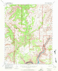
1953 Map of Orange Cliffs
USGS Topo · Published 1972About this map
Canyonlands National Park and the Glen Canyon National Recreation Area meet in this landscape of deep drainages and monolithic buttes. The map reveals a transition in land use and protection, showing a proposed boundary for the park extension across the Orange Cliffs and The Maze. Topographical details from the original 1953 survey, with atomic energy cooperation, highlight the remote infrastructure of the era, including a Landing Strip on Flint Flat and a Drill Hole in Gordon Flats. The confluence of the Colorado River and Lake Powell at Cataract Canyon anchors the southeast, while the intricate erosion of The Fins and Standing Rocks defines the eastern desert floor. Named water sources like French Spring and Big Water Spring signify the critical points of survival in this high-desert environment.
Find a feature on this map
61 named features on this map. Tap any name to fly to it.
Don’t see what you’re looking for? This feature index may not catch every label — zoom into the map to look around manually.
Map Details
Editions of this 1953 Orange Cliffs Map
3 editions found

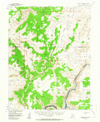
Other maps of this area

1885 · San Rafael
USGS Topo · 1:250,000

1885 · La Sal
USGS Topo · 1:250,000

1886 · Henry Mountains
USGS Topo · 1:250,000

1886 · Abajo
USGS Topo · 1:250,000

1892 · Abajo
USGS Topo · 1:250,000

1892 · Henry Mountains
USGS Topo · 1:250,000

1893 · Abajo
USGS Topo · 1:250,000

1935 · Elk Ridge
USGS Topo · 1:96,000

1940 · Elk Ridge
USGS Topo · 1:125,000

1951 · Upheaval Dome
USGS Topo · 1:62,500