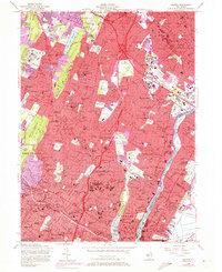
1955 Map of Orange
USGS Topo · Published 1972About this map
The eastern slopes of Watchung Mountain define this densely settled landscape during a period of intense post-war urbanization. The residential expansion of Montclair, Bloomfield, and Clifton is captured at a point when the Garden State Parkway had begun to reshape the local geography, cutting through established neighborhoods and industrial zones. Large-scale institutional land use is a prominent theme, from the extensive grounds of Overbrook Hospital and the County Sanatorium to the academic campus of the State Teachers College.
Find a feature on this map
178 named features on this map. Tap any name to fly to it.
Don’t see what you’re looking for? This feature index may not catch every label — zoom into the map to look around manually.
Map Details
Editions of this 1955 Orange Map
4 editions found
Other maps of this area

1888 · Plainfield
USGS Topo · 1:62,500

1888 · Morristown
USGS Topo · 1:62,500

1888 · Paterson
USGS Topo · 1:62,500

1892 · Paterson
USGS Topo · 1:62,500

1893 · Plainfield
USGS Topo · 1:62,500

1894 · Morristown
USGS Topo · 1:62,500

1898 · Morristown
USGS Topo · 1:62,500

1898 · Plainfield
USGS Topo · 1:62,500

1898 · Staten Island
USGS Topo · 1:62,500

1898 · Paterson
USGS Topo · 1:62,500