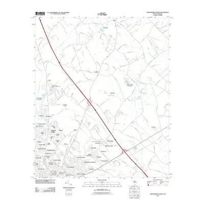
2011 Map of Orangeburg North
USGS Topo · Published 2011About this map
The northern expansion of Orangeburg is documented here in detail, revealing a landscape transitioning from the low-lying wetlands of Saddler Swamp and Bull Swamp into organized residential subdivisions. Modern neighborhoods such as Colonial Heights, Highland, and Wilkinson Heights frame the edges of the city, while academic institutions like the Claflin University Science Center Annex and South Carolina State University Mason Hall highlight the area's role as an educational hub.
Find a feature on this map
181 named features on this map. Tap any name to fly to it.
Don’t see what you’re looking for? This feature index may not catch every label — zoom into the map to look around manually.
Map Details
Editions of this 2011 Orangeburg North Map
This is the sole edition of this map. No revisions or reprints were ever made.
Other maps of this area

1920 · Bowman
USGS Topo · 1:48,000

1920 · Orangeburg
USGS Topo · 1:48,000

1921 · Orangeburg
USGS Topo · 1:62,500

1921 · Bowman
USGS Topo · 1:62,500

1943 · Bowman
USGS Topo · 1:62,500

1943 · Orangeburg
USGS Topo · 1:125,000

1943 · Orangeburg
USGS Topo · 1:62,500

1946 · Elloree
USGS Topo · 1:62,500

1946 · St. Matthews
USGS Topo · 1:62,500

1954 · Augusta
USGS Topo · 1:250,000