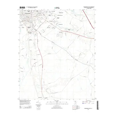
2014 Map of Orangeburg South
USGS Topo · Published 2014About this map
The city of Orangeburg serves as a dense educational and residential hub on the banks of the North Fork Edisto River. This landscape is defined by its historic collegiate institutions, including S Carolina State Univ, Claflin Univ, and Southern Methodist Coll, all concentrated in the northern city limits. Beyond the urban grid of streets like Russell St and Amelia St, the topography shifts into the lowland drainage basins of Middle Pen Swamp and Cow Castle Cr. Small residential developments like Brookdale, Quicktown, and Pine View radiate from the center, while the southern reach of the quadrangle descends toward the quiet settlement of Rowesville. The transition from the high ground of the Orangeburg Municipal Airport to the intricate wetlands of Whitford Stage Swamp illustrates the region's reliance on both modern infrastructure and the natural floodplain of the Edisto.
Find a feature on this map
120 named features on this map. Tap any name to fly to it.
Don’t see what you’re looking for? This feature index may not catch every label — zoom into the map to look around manually.
Map Details
Editions of this 2014 Orangeburg South Map
This is the sole edition of this map. No revisions or reprints were ever made.
Other maps of this area

1920 · Bowman
USGS Topo · 1:48,000

1920 · Orangeburg
USGS Topo · 1:48,000

1921 · Orangeburg
USGS Topo · 1:62,500

1921 · Bowman
USGS Topo · 1:62,500

1943 · Bowman
USGS Topo · 1:62,500

1943 · Orangeburg
USGS Topo · 1:125,000

1943 · Orangeburg
USGS Topo · 1:62,500

1946 · Elloree
USGS Topo · 1:62,500

1946 · St. Matthews
USGS Topo · 1:62,500

1954 · Augusta
USGS Topo · 1:250,000