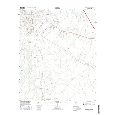
2017 Map of Orangeburg South
USGS Topo · Published 2017About this map
The southern portion of Orangeburg and its surrounding suburbs define this landscape along the North Fork Edisto River. The map shows a transition from the urban centers of Claflin Univ and South Carolina State Univ to the outlying residential areas of Brookdale, Wilkinson Heights, and Edisto. To the south, the landscape opens into agricultural and timber lands, punctuated by the Orangeburg Municipal Airport and smaller communities such as Felder and Rowesville.
Find a feature on this map
117 named features on this map. Tap any name to fly to it.
Don’t see what you’re looking for? This feature index may not catch every label — zoom into the map to look around manually.
Map Details
Editions of this 2017 Orangeburg South Map
This is the sole edition of this map. No revisions or reprints were ever made.
Other maps of this area

1920 · Bowman
USGS Topo · 1:48,000

1920 · Orangeburg
USGS Topo · 1:48,000

1921 · Orangeburg
USGS Topo · 1:62,500

1921 · Bowman
USGS Topo · 1:62,500

1943 · Bowman
USGS Topo · 1:62,500

1943 · Orangeburg
USGS Topo · 1:125,000

1943 · Orangeburg
USGS Topo · 1:62,500

1946 · Elloree
USGS Topo · 1:62,500

1946 · St. Matthews
USGS Topo · 1:62,500

1954 · Augusta
USGS Topo · 1:250,000