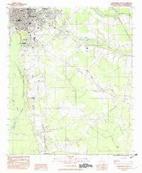
1982 Map of Orangeburg South
USGS Topo · Published 1982About this map
Orangeburg serves as a significant educational and transportation hub in this early 1980s record, anchored by institutions such as Claflin College, State College, and So Methodist College. The city's geography is defined by the winding course of the North Fork Edisto River, which borders the Orangeburg National Fish Hatchery and the Orangeburg Airport. A complex rail network including the Southern, Coast Line, and Seaboard lines illustrates the area's historical reliance on rail for commerce and travel.
Find a feature on this map
35 named features on this map. Tap any name to fly to it.
Don’t see what you’re looking for? This feature index may not catch every label — zoom into the map to look around manually.
Map Details
Editions of this 1982 Orangeburg South Map
2 editions found
Other maps of this area

1920 · Bowman
USGS Topo · 1:48,000

1920 · Orangeburg
USGS Topo · 1:48,000

1921 · Orangeburg
USGS Topo · 1:62,500

1921 · Bowman
USGS Topo · 1:62,500

1943 · Bowman
USGS Topo · 1:62,500

1943 · Orangeburg
USGS Topo · 1:125,000

1943 · Orangeburg
USGS Topo · 1:62,500

1946 · Elloree
USGS Topo · 1:62,500

1946 · St. Matthews
USGS Topo · 1:62,500

1954 · Augusta
USGS Topo · 1:250,000