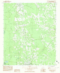
1982 Map of Branchville North
USGS Topo · Published 1983About this map
The Southern RR railroad line serves as a central spine through this South Carolina landscape, connecting the rural communities of Rowesville and Branchville. This 1980s-era documentation shows a region defined by its numerous small congregations and family burial grounds, including St Stephens Ch, Mays Chapel, and the Peter Bowman Cem. The local geography is heavily influenced by the drainage patterns of the Edisto River and its tributaries, such as Betty Branch and Staley Branch, which wind through the low-lying terrain.
Find a feature on this map
32 named features on this map. Tap any name to fly to it.
Don’t see what you’re looking for? This feature index may not catch every label — zoom into the map to look around manually.
Map Details
Editions of this 1982 Branchville North Map
This is the sole edition of this map. No revisions or reprints were ever made.
Other maps of this area

1919 · Lodge
USGS Topo · 1:62,500

1920 · Bowman
USGS Topo · 1:48,000

1920 · Lodge
USGS Topo · 1:48,000

1920 · Orangeburg
USGS Topo · 1:48,000

1920 · St. George
USGS Topo · 1:48,000

1921 · Orangeburg
USGS Topo · 1:62,500

1921 · Lodge
USGS Topo · 1:62,500

1921 · Bowman
USGS Topo · 1:62,500

1921 · St. George
USGS Topo · 1:62,500

1943 · Bowman
USGS Topo · 1:62,500