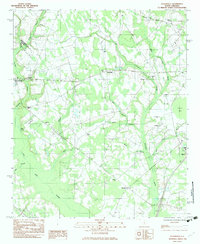
1982 Map of Felderville
USGS Topo · Published 1983About this map
Felderville and its surrounding wetlands define this rural landscape in the early 1980s, where the drainage networks of Four Hole Swamp and Goodbys Swamp carve through the agricultural fields of the coastal plain. The map documents a community deeply rooted in its local institutions, evidenced by the high density of country churches such as Saluda Ch, Red Hill Ch, and Friendship Ch. For genealogists, the survey identifies numerous family and community landmarks, including Bochette Cem, Antioch Cem, and the Island Cems near Bush Branch.
Find a feature on this map
29 named features on this map. Tap any name to fly to it.
Don’t see what you’re looking for? This feature index may not catch every label — zoom into the map to look around manually.
Map Details
Editions of this 1982 Felderville Map
This is the sole edition of this map. No revisions or reprints were ever made.
Other maps of this area

1920 · Eutawville
USGS Topo · 1:48,000

1920 · Bowman
USGS Topo · 1:48,000

1921 · Bowman
USGS Topo · 1:62,500

1921 · Eutawville
USGS Topo · 1:62,500

1943 · Bowman
USGS Topo · 1:62,500

1943 · Orangeburg
USGS Topo · 1:125,000

1943 · Eutawville
USGS Topo · 1:62,500

1946 · Elloree
USGS Topo · 1:62,500

1954 · Augusta
USGS Topo · 1:250,000

1957 · Augusta
USGS Topo · 1:250,000