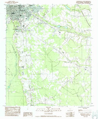
1982 Map of Orangeburg South
USGS Topo · Published 1988About this map
Claflin College and State College anchor the northern reaches of this coastal plain landscape, where the urban grid of Orangeburg gives way to an intricate network of wetlands and agricultural lands. The North Fork Edisto River snakes along the western edge, while a system of named waterways including Middle Pen Swamp, Cow Castle Creek, and Cattle Creek drain the low-lying terrain to the south and east.
Find a feature on this map
34 named features on this map. Tap any name to fly to it.
Don’t see what you’re looking for? This feature index may not catch every label — zoom into the map to look around manually.
Map Details
Editions of this 1982 Orangeburg South Map
2 editions found
Other maps of this area

1920 · Bowman
USGS Topo · 1:48,000

1920 · Orangeburg
USGS Topo · 1:48,000

1921 · Orangeburg
USGS Topo · 1:62,500

1921 · Bowman
USGS Topo · 1:62,500

1943 · Bowman
USGS Topo · 1:62,500

1943 · Orangeburg
USGS Topo · 1:125,000

1943 · Orangeburg
USGS Topo · 1:62,500

1946 · Elloree
USGS Topo · 1:62,500

1946 · St. Matthews
USGS Topo · 1:62,500

1954 · Augusta
USGS Topo · 1:250,000