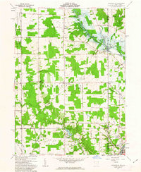
1961 Map of Orangeville
USGS Topo · Published 1963About this map
Hartford and Orangeville anchor this 1961 survey of the Ohio-Pennsylvania state line, where Trumbull County meets Mercer County. The landscape is defined by the early development of the Shenango River Reservoir and the recreational waters of Yankee Lake to the south. Local commerce and transit are marked by the presence of the New York Central and Erie-Lackawanna railroads, which served small rural centers like Burghill and Latimer.
Find a feature on this map
45 named features on this map. Tap any name to fly to it.
Don’t see what you’re looking for? This feature index may not catch every label — zoom into the map to look around manually.
Map Details
Editions of this 1961 Orangeville Map
4 editions found
Other maps of this area

1905 · Neshannock
USGS Topo · 1:62,500

1906 · Youngstown
USGS Topo · 1:62,500

1907 · Neshannock
USGS Topo · 1:62,500

1907 · Kinsman
USGS Topo · 1:62,500

1908 · Shenango
USGS Topo · 1:62,500

1908 · Youngstown
USGS Topo · 1:62,500

1950 · Cleveland
USGS Topo · 1:250,000

1954 · Sharon West
USGS Topo · 1:24,000

1954 · Girard
USGS Topo · 1:24,000

1956 · Cleveland
USGS Topo · 1:250,000