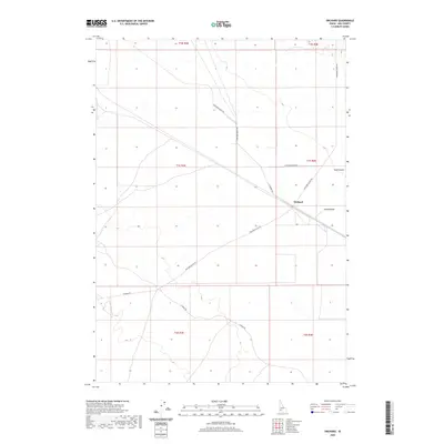
2020 Map of Orchard
USGS Topo · Published 2020About this map
Orchard serves as the central focal point of this arid landscape in Ada County, where the desert terrain is defined by a sparse but essential network of ranching and utility roads. The map reveals a land organized by the Public Land Survey System, including townships t1s r3e and t1s r4e, showing how the territory was partitioned into large blocks for grazing and access. Natural drainage is limited, with Bowns Cr and the topographical depression of Sand Hollow providing the primary geographical relief against the high desert plateau.
Find a feature on this map
17 named features on this map. Tap any name to fly to it.
Don’t see what you’re looking for? This feature index may not catch every label — zoom into the map to look around manually.
Map Details
Editions of this 2020 Orchard Map
This is the sole edition of this map. No revisions or reprints were ever made.
Other maps of this area

1892 · Mountain Home
USGS Topo · 1:125,000

1892 · Bisuka
USGS Topo · 1:125,000

1893 · Mountain Home
USGS Topo · 1:125,000

1894 · Bisuka
USGS Topo · 1:125,000

1948 · Big Foot Butte
USGS Topo · 1:24,000

1948 · Big Foot Butte
USGS Topo · 1:62,500

1948 · Little Joe Butte
USGS Topo · 1:24,000

1949 · Little Joe Butte
USGS Topo · 1:24,000

1955 · Christmas Mtn
USGS Topo · 1:24,000

1955 · Orchard
USGS Topo · 1:24,000