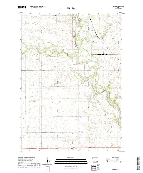
2022 Map of Orchard
USGS Topo · Published 2022About this map
Orchard serves as the central community on this landscape where Mitchell and Floyd counties meet. The town is surrounded by a dense grid of rural roads like Mitchell Line St and Orchard Rd, which partition the fertile agricultural land. Several small, family and community burial grounds are scattered throughout the countryside, including Tucker Cem, Dudley Cem, Calvary Cem, and Orchard Cem. These sites reflect the multi-generational settlement history of the region.
Find a feature on this map
47 named features on this map. Tap any name to fly to it.
Don’t see what you’re looking for? This feature index may not catch every label — zoom into the map to look around manually.
Map Details
Editions of this 2022 Orchard Map
This is the sole edition of this map. No revisions or reprints were ever made.
Other maps of this area

1954 · Mason City
USGS Topo · 1:250,000

1957 · Mason City
USGS Topo · 1:250,000

1958 · Mason City
USGS Topo · 1:250,000

1971 · Rockford
USGS Topo · 1:24,000

1971 · Orchard
USGS Topo · 1:24,000

1971 · Rudd
USGS Topo · 1:24,000

1971 · Charles City
USGS Topo · 1:24,000

1971 · Floyd
USGS Topo · 1:24,000
1971 · Roseville
USGS Topo · 1:24,000

1972 · Osage
USGS Topo · 1:24,000