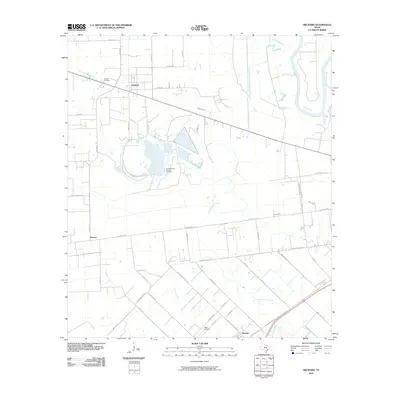
2010 Map of Orchard
USGS Topo · Published 2010About this map
The Orchard Dome Oil and Gas Field dominates the center of this landscape, illustrating the industrial footprint of resource extraction in Fort Bend County. The town of Orchard serves as the primary hub, with local history roots anchored at the nearby Orchard Cemetery. The terrain is defined by a dense network of watercourses, including the wide Brazos River at the northeast and various drainages like Sandy Branch, Cottonwood Creek, and Coon Creek that shape the agricultural layout.
Find a feature on this map
46 named features on this map. Tap any name to fly to it.
Don’t see what you’re looking for? This feature index may not catch every label — zoom into the map to look around manually.
Map Details
Editions of this 2010 Orchard Map
This is the sole edition of this map. No revisions or reprints were ever made.
Other maps of this area

1950 · Houston
USGS Topo · 1:250,000

1953 · Needville
USGS Topo · 1:24,000

1953 · Kendleton
USGS Topo · 1:24,000

1953 · Hungerford
USGS Topo · 1:24,000

1953 · Seguin
USGS Topo · 1:250,000

1955 · Richmond
USGS Topo · 1:62,500

1956 · Wallis
USGS Topo · 1:62,500

1956 · Houston
USGS Topo · 1:250,000

1958 · Seguin
USGS Topo · 1:250,000

1960 · Wallis
USGS Topo · 1:24,000