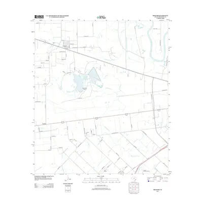
2013 Map of Orchard
USGS Topo · Published 2013About this map
Orchard serves as the primary hub of this Fort Bend County landscape, where residential streets like Magnolia St and Kibler St sit north of the local Orchard Cem. The surrounding territory is defined by a dense network of ranch roads and family-named routes, such as Galveston Rd and Moore Ranch Rd, reflecting a deeply rooted agricultural and petroleum economy. The presence of the Orchard Dome Oil and Gas Field near the center of the quadrangle highlights the industrial character of the region, where resource extraction occurs alongside established homesteads.
Find a feature on this map
55 named features on this map. Tap any name to fly to it.
Don’t see what you’re looking for? This feature index may not catch every label — zoom into the map to look around manually.
Map Details
Editions of this 2013 Orchard Map
This is the sole edition of this map. No revisions or reprints were ever made.
Other maps of this area

1950 · Houston
USGS Topo · 1:250,000

1953 · Needville
USGS Topo · 1:24,000

1953 · Kendleton
USGS Topo · 1:24,000

1953 · Hungerford
USGS Topo · 1:24,000

1953 · Seguin
USGS Topo · 1:250,000

1955 · Richmond
USGS Topo · 1:62,500

1956 · Wallis
USGS Topo · 1:62,500

1956 · Houston
USGS Topo · 1:250,000

1958 · Seguin
USGS Topo · 1:250,000

1960 · Wallis
USGS Topo · 1:24,000