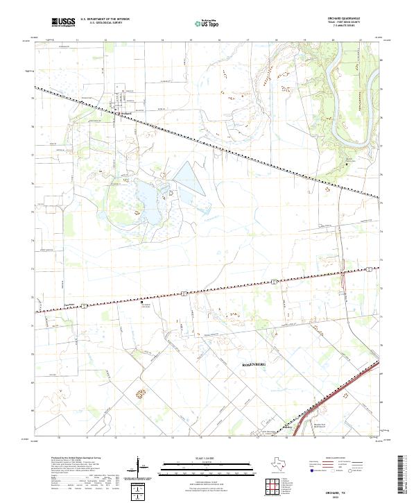
2022 Map of Orchard
USGS Topo · Published 2022About this map
The town of Orchard serves as the focal point of this Fort Bend County landscape, characterized by the meandering Brazos River along its eastern edge and a network of creeks including Sandy Br and Cottonwood Cr. The settlement pattern reflects the agricultural roots of the region, with family-named roads like Albert Marek Rd and Reinecker Rd radiating from the town center. Local history and genealogy are anchored by several burial grounds, including the Orchard Cem, San Gabriel Cem Annex, and the Barnett Family Cem. Further south, the map captures the outskirts of Rosenberg and the community of Beasley, where the Saint Wenceslaus Catholic Cem and the Houston Fort Bend Airport signify the area's continued infrastructure and growth. The landscape is defined by the transition from river bottomlands to the developed corridors of Tavener and beyond.
Find a feature on this map
71 named features on this map. Tap any name to fly to it.
Don’t see what you’re looking for? This feature index may not catch every label — zoom into the map to look around manually.
Map Details
Editions of this 2022 Orchard Map
This is the sole edition of this map. No revisions or reprints were ever made.
Other maps of this area

1950 · Houston
USGS Topo · 1:250,000

1953 · Needville
USGS Topo · 1:24,000

1953 · Kendleton
USGS Topo · 1:24,000

1953 · Hungerford
USGS Topo · 1:24,000

1953 · Seguin
USGS Topo · 1:250,000

1955 · Richmond
USGS Topo · 1:62,500

1956 · Wallis
USGS Topo · 1:62,500

1956 · Houston
USGS Topo · 1:250,000

1958 · Seguin
USGS Topo · 1:250,000

1960 · Wallis
USGS Topo · 1:24,000