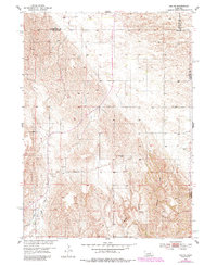
1954 Map of Ord NE
USGS Topo · Published 1985About this map
The rolling hills of Nebraska's Sandhills region define this landscape, recorded by the Geological Survey during the mid-20th century development of the Missouri River Basin. The terrain is notably sparse, characteristic of the rangeland along the borders of Garfield, Valley, and Wheeler counties. Agriculture and livestock management are the primary human imprints on the land, evidenced by several Windmill sites used for watering cattle across the undulating topography. Water management is a central theme of this 1950s study, featuring the Burwell Sumter Canal in the southwestern corner. Natural drainage is provided by local watercourses including Messenger Creek and a seasonal Spring, which cut through the loess hills and provide vital resources for the remote ranching operations established in this part of the state.
Find a feature on this map
9 named features on this map. Tap any name to fly to it.
Don’t see what you’re looking for? This feature index may not catch every label — zoom into the map to look around manually.
Map Details
Editions of this 1954 Ord NE Map
2 editions found
Other maps of this area

1954 · Ord SE
USGS Topo · 1:24,000

1954 · Ord
USGS Topo · 1:24,000

1954 · Gables SE
USGS Topo · 1:24,000

1954 · Gables SW
USGS Topo · 1:24,000

1954 · Ord NE
USGS Topo · 1:24,000

1954 · Horace
USGS Topo · 1:24,000

1954 · Ord NW
USGS Topo · 1:24,000

1954 · Greeley NW
USGS Topo · 1:24,000

1954 · Ericson
USGS Topo · 1:24,000

1955 · Broken Bow
USGS Topo · 1:250,000