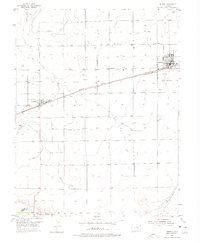
1954 Map of Ordway
USGS Topo · Published 1975About this map
Ordway and Crowley anchor this agricultural landscape in the mid-1950s, revealing a complex network of irrigation that defines life in this corner of Colorado. The map traces the essential water management systems that draw from the Arkansas River, which flows along the southern edge of the survey. The intricate grid of canals and ditches surrounding these towns highlights the area's transition from open prairie to a productive farming district. To the southeast, the Lake Meredith Reservoir Outlet and the wandering path of Bob Creek further illustrate the region's reliance on managed water resources. This survey captures the small-town layout and infrastructure of Crowley County at a time when the railroad and irrigation systems were the primary drivers of local development and economic stability.
Find a feature on this map
6 named features on this map. Tap any name to fly to it.
Don’t see what you’re looking for? This feature index may not catch every label — zoom into the map to look around manually.
Map Details
Editions of this 1954 Ordway Map
2 editions found
Other maps of this area

1891 · Catlin
USGS Topo · 1:125,000

1893 · Catlin
USGS Topo · 1:125,000

1954 · Olney Springs
USGS Topo · 1:24,000

1954 · Elder
USGS Topo · 1:24,000

1954 · Sugar City
USGS Topo · 1:24,000

1954 · Ordway
USGS Topo · 1:24,000

1954 · Manzanola
USGS Topo · 1:24,000

1954 · Lamar
USGS Topo · 1:250,000

1955 · Rocky Ford
USGS Topo · 1:24,000

1958 · Lamar
USGS Topo · 1:250,000