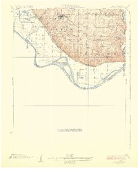
1926 Map of Oregon
USGS Topo · Published 1926About this map
The bluffs of the Missouri River and the broad bottomlands of Holt and Doniphan Counties define this 1920s landscape. This survey, conducted by C.L. Sadler and released by the State of Missouri Bureau of Geology and Mines, illustrates the transition from the high ridges of Oregon down to the rail-side settlements of Forest City and Forbes. The Missouri River's shifting path is captured before modern channelization, showing complex sandbars and islands near the Nodaway River confluence.
Find a feature on this map
38 named features on this map. Tap any name to fly to it.
Don’t see what you’re looking for? This feature index may not catch every label — zoom into the map to look around manually.
Map Details
Editions of this 1926 Oregon Map
3 editions found
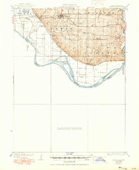
Other maps of this area

1885 · Atchison
USGS Topo · 1:125,000

1888 · Atchison
USGS Topo · 1:125,000

1893 · Atchison
USGS Topo · 1:125,000

1920 · Craig
USGS Topo · 1:62,500

1924 · St. Joseph
USGS Topo · 1:62,500

1926 · Atchison
USGS Topo · 1:62,500

1926 · Saint Joseph
USGS Topo · 1:62,500

1926 · Oregon
USGS Topo · 1:62,500

1926 · Maitland
USGS Topo · 1:62,500

1927 · Dearborn
USGS Topo · 1:62,500