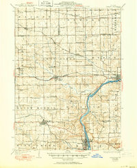
1924 Map of Oregon
USGS Topo · Published 1950About this map
The Rock River carves a deep valley through this northern Illinois landscape, serving as a geographic anchor for the town of Oregon. In the years following World War II, the region remained a patchwork of small agricultural townships like Seward, Marion, and Pine Rock, where rural life centered on an exceptionally dense network of country schools and churches. Three major rail lines, including the Chicago Milwaukee and St Paul and the Chicago Great Western, intersect the prairie, facilitating the movement of goods between the river towns and distant markets.
Find a feature on this map
78 named features on this map. Tap any name to fly to it.
Don’t see what you’re looking for? This feature index may not catch every label — zoom into the map to look around manually.
Map Details
Editions of this 1924 Oregon Map
3 editions found
Other maps of this area

1917 · Kings
USGS Topo · 1:62,500

1918 · Rockford
USGS Topo · 1:62,500

1918 · Dixon
USGS Topo · 1:62,500

1918 · Kings
USGS Topo · 1:62,500

1922 · Oregon
USGS Topo · 1:62,500

1924 · Oregon
USGS Topo · 1:62,500

1930 · Woodsung
USGS Topo · 1:48,000

1932 · Pecatonica
USGS Topo · 1:62,500

1936 · Pecatonica
USGS Topo · 1:62,500

1938 · Rockford
USGS Topo · 1:62,500