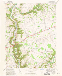
1968 Map of Oregonia
USGS Topo · Published 1970About this map
Fort Ancient State Memorial dominates the southern landscape of this Warren County survey, preserving ancient burial mounds and a stone circle high above the winding Little Miami River. The river corridor serves as the primary artery for both the Penn Central railroad and a string of riverside communities including Oregonia and Mathers Mills. The surrounding uplands of Wayne and Washington townships are defined by a dense network of family-named roads such as O'Neall Road and Lukens Road, connecting remote farmsteads to rural centers like Wellman.
Find a feature on this map
89 named features on this map. Tap any name to fly to it.
Don’t see what you’re looking for? This feature index may not catch every label — zoom into the map to look around manually.
Map Details
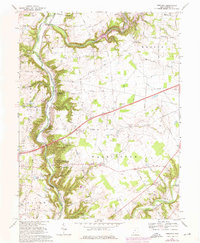
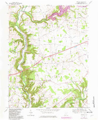
Editions of this 1968 Oregonia Map
3 editions found
Other maps of this area

1907 · Blanchester
USGS Topo · 1:62,500

1913 · Waynesville
USGS Topo · 1:62,500

1914 · Morrow
USGS Topo · 1:62,500

1915 · Waynesville
USGS Topo · 1:62,500

1916 · Morrow
USGS Topo · 1:62,500

1917 · Xenia
USGS Topo · 1:62,500

1947 · Columbus
USGS Topo · 1:250,000

1953 · Cincinnati
USGS Topo · 1:250,000

1955 · New Burlington
USGS Topo · 1:24,000
1955 · Lebanon
USGS Topo · 1:24,000