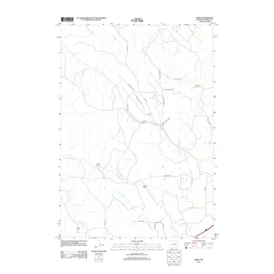
2012 Map of Oriva
USGS Topo · Published 2012About this map
The Kitty Oil and Gas Field dominates the northeastern landscape of this Campbell County region, reflecting the industrial character of the Powder River Basin in the early 21st century. The small settlement of Oriva serves as a central point for a network of local thoroughfares, including Oriva Rd and Echeta Rd, which navigate a terrain defined by complex drainage systems and draws. Water sources like Red Hill Spring and Force Reservoir highlight the critical role of water management in this arid ranching and energy-producing environment.
Find a feature on this map
33 named features on this map. Tap any name to fly to it.
Don’t see what you’re looking for? This feature index may not catch every label — zoom into the map to look around manually.
Map Details
Editions of this 2012 Oriva Map
This is the sole edition of this map. No revisions or reprints were ever made.
Other maps of this area

1954 · Gillette
USGS Topo · 1:250,000

1955 · Gillette
USGS Topo · 1:250,000

1958 · Gillette
USGS Topo · 1:250,000

1962 · Gillette
USGS Topo · 1:250,000
1971 · Scott Dam
USGS Topo · 1:24,000
1971 · Oriva NW
USGS Topo · 1:24,000
1971 · Oriva
USGS Topo · 1:24,000
1971 · Appel Butte
USGS Topo · 1:24,000
1971 · Gillette West
USGS Topo · 1:24,000
1971 · Four Bar J Ranch
USGS Topo · 1:24,000