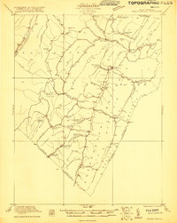
1921 Map of Orkney Springs
USGS Topo · Published 1921About this map
Lost City and Mathias serve as the primary hubs in this corner of Hardy County, where the settlement pattern follows the narrow valley of the Lost River. Surveyed in 1921, the landscape is densely populated with community landmarks, including a remarkable concentration of local education and religious sites like Shoemaker School, Straderman School, and Holly Hill Church. The terrain is defined by the massive ridges of Lost River Mountain and Shenandoah Mountain, which create natural barriers along the West Virginia and Virginia border.
Find a feature on this map
63 named features on this map. Tap any name to fly to it.
Don’t see what you’re looking for? This feature index may not catch every label — zoom into the map to look around manually.
Map Details
Editions of this 1921 Orkney Springs Map
2 editions found
Other maps of this area

1891 · Romney
USGS Topo · 1:125,000

1892 · Franklin
USGS Topo · 1:125,000

1892 · Woodstock
USGS Topo · 1:125,000

1895 · Piedmont
USGS Topo · 1:125,000

1896 · Franklin
USGS Topo · 1:125,000

1920 · Petersburg
USGS Topo · 1:48,000

1920 · Moorefield
USGS Topo · 1:62,500

1921 · Orkney Springs
USGS Topo · 1:48,000

1921 · Petersburg
USGS Topo · 1:48,000

1921 · Greenland Gap
USGS Topo · 1:62,500