
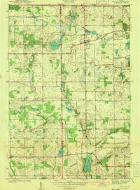
1941 Map of Orland
USGS Topo · Published 1941About this map
Orland serves as a central hub in this late-1930s landscape, positioned near the Orland Fish Hatchery and several glacial water bodies. The terrain is defined by a dense network of lakes and marshes, including Wall Lake, Otter Lake, and the connected Deep Lake and Shallow Lake. These natural features dictated the early settlement patterns and road placements, such as the prominent Vistula Road cutting across the northern sections.
Find a feature on this map
35 named features on this map. Tap any name to fly to it.
Don’t see what you’re looking for? This feature index may not catch every label — zoom into the map to look around manually.
Map Details
Editions of this 1941 Orland Map
2 editions found
Other maps of this area

1940 · Orland
USGS Topo · 1:24,000

1941 · Angola West
USGS Topo · 1:24,000

1942 · Ashley
USGS Topo · 1:24,000

1942 · Angola West
USGS Topo · 1:24,000

1942 · Stroh
USGS Topo · 1:24,000

1947 · Mongo
USGS Topo · 1:24,000

1947 · Wolcottville
USGS Topo · 1:24,000

1953 · Fort Wayne
USGS Topo · 1:250,000

1956 · Fort Wayne
USGS Topo · 1:250,000

1959 · Wolcottville
USGS Topo · 1:24,000