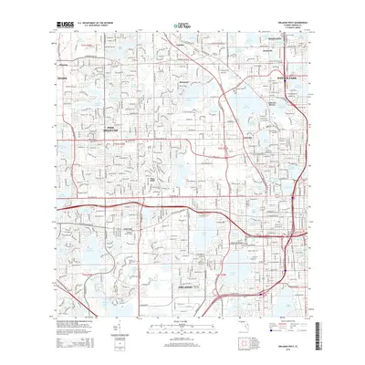
2015 Map of Orlando West
USGS Topo · Published 2015About this map
Orlando's western urban reach is defined by a dense mosaic of residential developments and numerous freshwater bodies, reflecting the rapid growth of Central Florida. The landscape includes established communities like Pine Hills CDP, Orlovista, and the historic town of Eatonville. This 2015 survey reveals a complex transportation network centered around W Colonial Dr and the President Barack Obama Pky. Cultural and educational landmarks are prominent throughout the area, from Valencia Community Coll to the Washington Park Cem. Significant water features such as Lake Hiawassee, Turkey Lake, and Clear Lake serve as focal points for local geography, illustrating the region's reliance on its lake system for community identity and urban planning. The map also documents institutional presences like the Centura Institute and Everest University-North Orlando.
Find a feature on this map
104 named features on this map. Tap any name to fly to it.
Don’t see what you’re looking for? This feature index may not catch every label — zoom into the map to look around manually.
Map Details
Editions of this 2015 Orlando West Map
This is the sole edition of this map. No revisions or reprints were ever made.
Other maps of this area

1953 · Lake Jessamine
USGS Topo · 1:24,000

1953 · Pine Castle
USGS Topo · 1:24,000

1953 · Windermere
USGS Topo · 1:24,000

1955 · Orlando
USGS Topo · 1:250,000

1956 · Winter Garden
USGS Topo · 1:24,000

1956 · Orlando West
USGS Topo · 1:24,000

1956 · Orlando East
USGS Topo · 1:24,000

1957 · Orlando
USGS Topo · 1:250,000

1958 · Orlando
USGS Topo · 1:250,000

1959 · Forest City
USGS Topo · 1:24,000