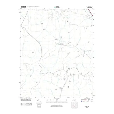
2010 Map of Orme
USGS Topo · Published 2010About this map
Orme and the surrounding Tennessee highlands are defined by a complex network of narrow valleys and ridges, reflecting a landscape long shaped by small-scale coal mining and mountain agriculture. The southern portion of the map centers on the community of Orme, where industrial history is evident at the Battle Creek Mines and the Payne Number 1 Mine located near Old Shop Hollow. These sites, along with the Bolton Mines further north, illustrate the extraction economy that once dominated this section of Marion County.
Find a feature on this map
81 named features on this map. Tap any name to fly to it.
Don’t see what you’re looking for? This feature index may not catch every label — zoom into the map to look around manually.
Map Details
Editions of this 2010 Orme Map
This is the sole edition of this map. No revisions or reprints were ever made.
Other maps of this area

1886 · Stevenson
USGS Topo · 1:125,000

1892 · Stevenson
USGS Topo · 1:125,000

1895 · Stevenson
USGS Topo · 1:125,000

1895 · Sewanee
USGS Topo · 1:125,000

1936 · Sewanee
USGS Topo · 1:24,000

1936 · Orme
USGS Topo · 1:24,000

1936 · Bridgeport
USGS Topo · 1:24,000

1936 · Sinking Cove
USGS Topo · 1:24,000

1936 · Monteagle
USGS Topo · 1:24,000

1936 · White City
USGS Topo · 1:24,000