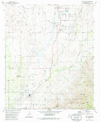
1981 Map of Oro Valley
USGS Topo · Published 1986About this map
Cañada del Oro carves through this Pima County landscape, serving as a central artery for the emerging suburban growth and agricultural legacy of the region. By the early 1980s, Oro Valley was expanding toward the foothills, evidenced by the development of Canyon del Oro High Sch and several residential blocks along Linda Vista Blvd. This period captures a transition from large ranching operations like the historic Steam Pump Ranch and Golder Ranch toward more structured community planning, including Dennis Weaver Park.
Find a feature on this map
50 named features on this map. Tap any name to fly to it.
Don’t see what you’re looking for? This feature index may not catch every label — zoom into the map to look around manually.
Map Details
Editions of this 1981 Oro Valley Map
3 editions found
Other maps of this area

1904 · Tucson
USGS Topo · 1:125,000

1905 · Tucson
USGS Topo · 1:125,000

1911 · Winkelman
USGS Topo · 1:125,000

1913 · Winkelman
USGS Topo · 1:125,000

1934 · Tucson Mountains
USGS Topo · 1:125,000

1934 · Newman Peak
USGS Topo · 1:125,000

1947 · Cortaro
USGS Topo · 1:62,500

1956 · Tucson
USGS Topo · 1:250,000

1957 · Sabino Canyon
USGS Topo · 1:24,000

1957 · Cortaro
USGS Topo · 1:62,500