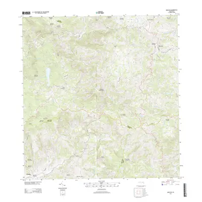
2013 Map of Orocovis
USGS Topo · Published 2013About this map
Orocovis and Villalba anchor this interior portion of the Island of Puerto Rico, where the central Cordillera Central dictates a landscape of steep peaks and winding watercourses. The 2013 survey reveals an intricate drainage network where the Rio Matrullas feeds into Lago de Matrullas, a significant reservoir in the western section of the map. High elevations are defined by prominent landmarks such as Cerro Doña Juana and Cerro Mime, illustrating the island's formidable central spine. The transport system relies on narrow routes like PR-143 and PR-151, which navigate the sharp contours between deep valleys such as those carved by the Rio Bauta and Rio Orocovis. This map serves as a detailed record of land use and topography in the heart of the Orocovis-Villalba region, capturing the physical barriers and connections between these mountain communities.
Find a feature on this map
48 named features on this map. Tap any name to fly to it.
Don’t see what you’re looking for? This feature index may not catch every label — zoom into the map to look around manually.
Map Details
Editions of this 2013 Orocovis Map
This is the sole edition of this map. No revisions or reprints were ever made.
Other maps of this area

1945 · Ponce
USGS Topo · 1:30,000

1945 · Rio Descalabrado
USGS Topo · 1:30,000

1946 · Coamo
USGS Topo · 1:30,000

1946 · Corozal
USGS Topo · 1:30,000

1946 · Barranquitas
USGS Topo · 1:30,000

1946 · Ciales
USGS Topo · 1:30,000

1946 · Jayuya
USGS Topo · 1:30,000

1946 · Florida
USGS Topo · 1:30,000

1946 · Orocovis
USGS Topo · 1:30,000

1947 · Corozal SO
USGS Topo · 1:10,000