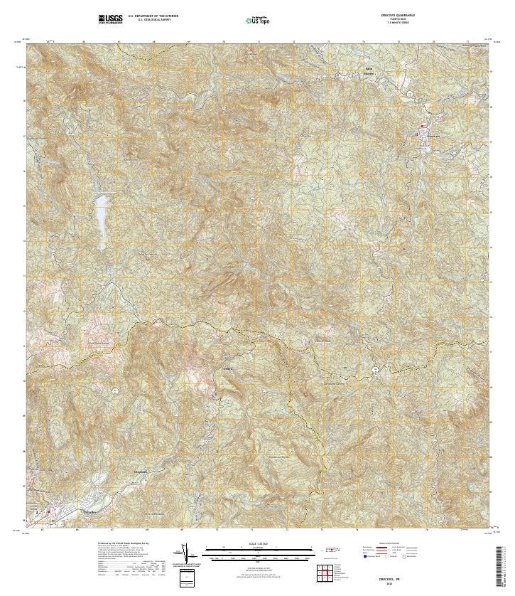
2024 Map of Orocovis
USGS Topo · Published 2024About this map
The Cordillera Central spine dominates this interior region of the Island of Puerto Rico, where deep valleys and high peaks dictate the layout of high-altitude settlements and winding mountain roads. The municipal center of Orocovis sits in the northeast, marked by local landmarks such as the Tribunal de Orocovis. To the southwest, the town of Villalba anchors the lower slopes, near the Cementerio Civil de Villalba. This landscape is defined by its water resources, most notably the Lago de Matrullas which collects the flow of the Río Matrullas. Transport through this difficult terrain relies on the famous Panoramica and Carr 143, which trace the ridgelines. The map reveals a network of rural sectors, including Sec Los Alvarado and Sec Guabagauto, illustrating the dispersed residential patterns typical of the Puerto Rican highlands.
Find a feature on this map
55 named features on this map. Tap any name to fly to it.
Don’t see what you’re looking for? This feature index may not catch every label — zoom into the map to look around manually.
Map Details
Editions of this 2024 Orocovis Map
This is the sole edition of this map. No revisions or reprints were ever made.
Other maps of this area

1945 · Ponce
USGS Topo · 1:30,000

1945 · Rio Descalabrado
USGS Topo · 1:30,000

1946 · Coamo
USGS Topo · 1:30,000

1946 · Corozal
USGS Topo · 1:30,000

1946 · Barranquitas
USGS Topo · 1:30,000

1946 · Ciales
USGS Topo · 1:30,000

1946 · Jayuya
USGS Topo · 1:30,000

1946 · Florida
USGS Topo · 1:30,000

1946 · Orocovis
USGS Topo · 1:30,000

1947 · Corozal SO
USGS Topo · 1:10,000