
1967 Map of Orofino East
USGS Topo · Published 1971About this map
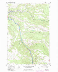
Orofino serves as the focal point for this mid-century topographical study, situated at the dramatic confluence of Orofino Creek and the Clearwater River. The settlement pattern reflects the area's difficult geography, with roads like the Gilbert Grade navigating the steep elevation changes between the river valley and the elevated Camas Prairie. The landscape is a mix of industrial and civic development, featuring a Quarry, a prominent High Sch, and the Radio Towers (KLER) overlooking the town.
Find a feature on this map
20 named features on this map. Tap any name to fly to it.
Don’t see what you’re looking for? This feature index may not catch every label — zoom into the map to look around manually.
Map Details
Editions of this 1967 Orofino East Map
2 editions found
Other maps of this area

1924 · Kamiah
USGS Topo · 1:125,000

1955 · Pullman
USGS Topo · 1:250,000

1958 · Pullman
USGS Topo · 1:250,000

1961 · Ahsahka
USGS Topo · 1:62,500

1967 · Mohler
USGS Topo · 1:24,000

1967 · Sixmile Creek
USGS Topo · 1:24,000

1967 · Rudo
USGS Topo · 1:24,000

1967 · Orofino West
USGS Topo · 1:24,000
1967 · Woodland
USGS Topo · 1:24,000
1969 · Grangemont
USGS Topo · 1:24,000